Archive Record
Images
Metadata
Catalog Number |
2012.050.208 |
Object Name |
Map |
Date |
1940 |
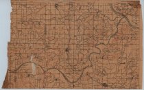
Scope & Content |
Topographical map from the U.S. Geological Survey measuring 14.25" x 9.25." This section of map shows the Sanbois Quadrangle. Included on the map are portions of Oklahoma counties Muskogee, Haskell, and McIntosh, with various early schools and communities denoted. |
Search Terms |
Haskell County, OK maps Muskogee County, OK Oklahoma topographical maps U.S. Geological Survey |