Archive Record
Images
Metadata
Catalog Number |
2024.045.032 |
Collection |
New, James Richard |
Object Name |
Map |
Date |
1973 |
Scope & Content |
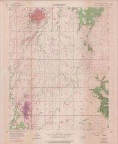
Topography map measuring 21.75" x 27" and produced in 1956 and revised in 1973 by the United States Department of the Interior Geological Survey showing the Oklahoma Collinsville Quadrangle. The map includes the area from Township 22 North on the north, Township 21 North on the South, Range 13 East on the west, and Range 15 East on the east. The city of Owasso in Tulsa County, OK, is visible near the lower left. The city of Collinsville, in Tulsa County, OK, is visible near the upper left. A portion of the Caney River is visible in the upper right. The Atchison, Topeka and Santa Fe Railway runs between Owasso and Collinsville at the left margin. The map also delineates the location of houses, gravel pits, strip mines, oil wells, and cemeteries. |
Search Terms |
Atchison, Topeka and Santa Fe Railway Caney River Collinsville, OK maps oil & gas wells oilfields Owasso, OK petroleum industry Rogers County, OK topographical maps Tulsa County, OK |