Archive Record
Images
Metadata
Catalog Number |
2022.207.012D |
Collection |
Hart, Donna L. |
Object Name |
Map |
Date |
1983 |
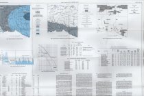
Scope & Content |
Hydrological map measuring 37" x 28.75" published by the Oklahoma Geological Survey in cooperation of the United States Geological Survey under the direction of Charles J. Mankin. This map is entitled "Reconnaissance of the Water Resources of the McAlester and Texarkana Quadrangles, Southeastern Oklahoma" and was created by Melvin V. Marcher and DeRoy L. Bergman. It was printed by Pikes Peak Lithographing Company, Colorado Springs, CO, in 1983; a second printing was run in 1994. The map focuses on the region's available water resources and use. |
Search Terms |
geologists & geology maps Oklahoma Oklahoma Geological Survey topographical maps |